Blog
How to Create Optimized Waste Collection Routes With Live Maps
by Joel Scott • October 2, 2026
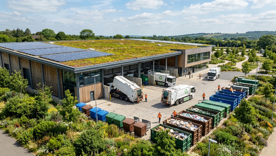
Picking up thousands of bins a day without missing a beat or running out of fuel or hours looks simple from the curb. It is not. Anyone who has tried to plan routes for a fleet of 20 or 50 trucks across busy neighborhoods knows it feels like solving a giant, moving puzzle. One-way streets, morning rush hour, sudden road closures, overloaded bins. Paper maps and static spreadsheets cannot keep up with any of it.
Building optimized waste collection routes and running them on live maps is not only possible, but it is also how modern waste operations run every day. It comes down to four steps: plan the routes, get them into the cab, track them live throughout the day, and use the results to improve the next set. Here is how each step works, and how Routeware helps at every stage.
Key Takeaways
- Optimized waste collection routes are built by software on real data, balancing stops, truck weights, and drive times so no driver finishes at 1 pm while another works late.
- Waste routing is not regular GPS: it must handle side-of-street collection, dangerous turns, weight limits, and trips to the landfill or transfer station.
- Live maps turn a route plan into an operation you can steer, so dispatchers can see every truck and answer “where is my truck” in seconds.
- Plan-versus-actual data closes the loop, so routes get faster, safer, and more accurate each week.
What Are Optimized Waste Collection Routes?
Optimized waste collection routes are collection routes designed by software rather than by hand, built to cover a service area with the fewest miles, the most balanced workload, and the safest stop sequence. Instead of routes drawn once and left alone, they are updated on real operational data, stops, container types, weights, and drive times, and paired with live systems so the office can see the routes running live. Routeware’s route optimization is built to make that practical at fleet scale.
How Do You Plan Optimized Waste Collection Routes?
Before a truck starts its engine, the software does the heavy lifting. It balances the workload so stops, truck capacity, and travel times are spread evenly across days and crews, instead of one driver finishing early. At the same time, another runs late into the evening.
It also brings side-of-street intelligence that standard GPS lacks. Waste trucks need to minimize dangerous turns, avoid crossing oncoming traffic on busy roads, and handle narrow cul-de-sacs cleanly. It also plans around heavy loads, vehicle weight limits, bridge restrictions, and scheduled trips to landfills or transfer stations, so trucks unload before they overload and drivers finish their shifts on time.
How Do Optimized Routes Reach Drivers in the Cab?
A route plan is only as good as what happens in the cab. Optimized routes go straight to an in-cab tablet as turn-by-turn directions and a digital manifest, so the clipboard disappears.
That matters most when a regular driver is out. A backup driver does not need to guess where the hidden bins or tricky alleyways are; the system guides them step by step, and stops stop getting missed. And when something is off at the curb – a bin not out, a car blocking the driveway, a dumpster overfilled – the driver logs it with a tap and a photo, on the fly.
How Do Live Maps Track Waste Collection Routes in Real Time?
This is where optimized routes become an operation you can steer. Dispatchers and customer service see every truck’s live location, route progress, and breadcrumb trail on a digital map, in real time.
That changes the hardest customer conversation in the business. When a resident calls asking, “Where is my truck?” or “Why was my bin missed?” customer service can look at the map and answer on the spot: the truck already passed, it is running 15 minutes behind, or a photo shows the bin wasn’t at the curb. Service can also be verified automatically as the truck drives past a geocoded address, or confirmed by arm sensors and lift switches, so a completed stop is a fact, not a guess. And the map keeps the day flexible: a last-minute bulky-item pickup or a construction roll-off drop can be slotted straight into a driver’s live schedule.
How Do You Keep Waste Collection Routes Optimized Over Time?
By collecting real-world data, you are able to compare what was planned against what really happened. Did one neighborhood take 45 minutes longer than expected because of school traffic? Are specific trucks filling up too early? The plan-versus-actual view answers those questions with real GPS drive trails, shift hours, and stop times.
With that data, managers tune stop times, rebalance territories, and shave off unnecessary miles and fuel, week after week. Optimized routes are not a one-time project; they get a little better every cycle. For a deeper walkthrough of the planning side, our guide to better collection routes breaks it into seven steps.
Manual Collection vs Optimized Routes With Live Maps
The difference between running collection on spreadsheets and running it on optimized routes with live maps shows up at every step:
| Manual collection | Optimized routes with live maps | |
|---|---|---|
| Planning | Out of date routes, redrawn rarely | Balanced routes built on real stops, weights, and drive times |
| In the cab | Printed manifests and local knowledge | Turn-by-turn guidance any driver can follow |
| During the day | No visibility until trucks return | Every truck live on the map, in real time |
| Missed-stop calls | Guesswork and multiple go-backs | Photo and GPS proof in seconds |
| Getting better | Gut feel | Plan-vs-actual data to tune the next route |
How Concord Cut Go-Backs With Real-Time Route Visibility
The City of Concord, North Carolina, shows what optimized routes plus live maps deliver. When Concord brought its waste operations in-house, it paired route optimization with real-time visibility, putting its routes on the Routeware driver app and live GPS tracking so dispatchers could see the whole fleet on the map and verify what happened at every stop.
Live-map visibility drove the results. Because the office could see whether a truck had passed an address and whether a bin was out, go-backs dropped sharply – no more sending a truck across town on a guess. Concord saved about $320,000 a year, cut average route time by roughly an hour, and avoided an estimated 200,000 pounds of CO2, all while running the operation with its own team and answering residents with real data instead of guesswork.
Optimized Routes and Live Maps Are the New Baseline
Optimized waste collection routes and live maps are no longer a nice-to-have. They are how a modern fleet runs. The plan is balanced before the trucks roll. The driver is guided turn by turn. The office sees every truck in real time and can prove what happened at any stop. And the data sharpens future route plans. Paper maps and spreadsheets deliver none of that, and operations still running on them fall further behind with every route.
Routeware brings all four steps together on one platform, so a city or hauler can plan, guide, track, and improve its collection routes without stitching separate tools together. See how Routeware’s route optimization would work for your fleet.
Frequently Asked Questions
Optimized waste collection routes are collection routes designed by software to cover a service area with the fewest miles, the most balanced workload, and the safest stop sequence. They are built on real data like stops, weights, and drive times, rather than drawn by hand and left unchanged, so the fleet runs leaner and more predictably.
Regular GPS finds the fastest path between two points. Waste routing must handle collection realities: side-of-street pickups, minimizing dangerous turns, vehicle weight limits and bridge restrictions, and scheduled trips to the landfill or transfer station. That is why waste operations use purpose-built routing rather than consumer navigation.
Live maps give dispatchers and customer service real-time visibility into every truck’s location and route progress. They make it possible to answer “where is my truck” instantly, verify whether a stop was serviced, and slot in last-minute pickups mid-route, turning a static plan into an operation the office can steer throughout the day.
Yes. With live tracking and service verification, the office can see whether a truck passed an address and when, and drivers can capture a photo when a bin is not out. That replaces guesswork with proof, so a missed-pickup call is resolved in seconds and unnecessary go-backs are avoided, as the City of Concord found when it cut go-backs with real-time visibility.
Routing works best as an ongoing process, not a one-time project. By reviewing plan-versus-actual data, real drive times, shift hours, and stop times, teams can tune stop times and rebalance territories on a regular cadence, so routes stay fast and accurate as neighborhoods, traffic, and volumes change.
About the Author

Joel Scott
Joel Scott leads product marketing at Routeware. With more than two decades of experience in enterprise software for the public and private sectors across the UK and North America, Joel writes on the critical operational and technology challenges facing governments and resource management companies today.
 North America
  United Kingdom