Blog
How Municipal Fleets Handle Disaster Debris Management
by Katie Kinnear • October 9, 2026
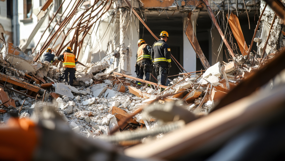
A city purchases a municipal fleet along with a mapping platform to manage its day-to-day responsibilities, such as collecting trash, recycling, and yard waste. Most teams don’t anticipate how they’ll repurpose the same tools when something unexpected happens. The real-time tracking of vehicles, mapping technology, and operational systems that keep collection trucks running on a typical Tuesday are exactly what a city needs when facing an unplanned crisis. Disaster debris management is a prime example.
When a major storm or flood occurs, neighborhoods, roads, and waterways can quickly become buried under fallen trees, damaged property, and debris. For residents in these areas, this means flooded homes, destroyed belongings, and sewage overflows. For the city, it results in a large-scale, high-pressure cleanup operation that the regular waste collection system was never designed to handle. However, cities that respond most effectively do not introduce new technology during a crisis; instead, they rely on the fleet of vehicles they already own, using them more intensively and often in ways they were not originally intended. Below is an explanation of how disaster debris management serves as a non-traditional use of a municipal fleet, along with six lessons learned from public works teams.
Key Takeaways
- Disaster debris management refers to how a city plans, organizes, records, and documents debris removal after a storm, flood, or other disaster.
- A debris event occurs suddenly and on a massive scale, often when the city’s own facilities and routes are already damaged.
- With real-time impact mapping, supervisors can see where the damage is most severe and send crews there, rather than trying to determine locations from paper maps.
- The most important lesson is preparation – the systems, data structure, and integrations that carry a crisis were built during calm times, not during the storm.
What Is Disaster Debris Management?
The management of disaster debris involves planning for, gathering, keeping records of, and documenting the debris left behind by a disaster such as fallen trees, items soaked by floodwater, wreckage from construction, and hazardous materials that a storm or other kind of event deposits throughout a community. This work sits at the intersection of public works, emergency management, and solid waste, and it must be carried out quickly on a massive scale with records detailed enough to qualify for federal reimbursement.
The difficulty is in reacting with confident agility, even when the normal systems for public works responsibilities are damaged. Roads become blocked, facilities lose power, and standard routes become unusable. Cities that respond effectively don’t rely on improvisation; instead, they follow a plan based on infrastructure and technology prepared in advance.
How Real-Time Mapping Changes a Debris Response
The main difference between a slow response and a quick one is a city’s the visibility of the extent of the damage. The contrast between the conventional method and one that is based on mapping is sharp:
| Traditional debris response | Mapping-driven debris response |
|---|---|
| Paper maps and quarter-section views pulled from binders | Live density maps refreshed in real time |
| No easy way to see where damage concentrates | Wide and street-level views of the hardest-hit areas |
| Supervisors guess where to send crews next | Crews sent to the highest-impact areas first |
| Office and field work from different information | One operational view shared across the operation |
| Records reconstructed after the fact | A documented record built as the work happens |
What enables a city to send its limited resources and personnel to the areas that most need them first is the change in approach, from merely guessing where to send crews to observing where the damage is most concentrated.
6 Disaster Debris Management Lessons for Cities
Across recent large-scale flood responses, six lessons stand out for any city facing a debris event:
- Build the data foundation before the disaster: The cities that respond fastest have already created digitized routes, established their mapping data as the source of truth, and connected it to their routing platform and 311 system. Because that structure exists before the event, they can use mapping, routing, and operational data immediately, without inventing new workflows in the middle of the emergency. That is why a scalable municipal platform pays off long before the first storm.
- Trade paper maps for real-time impact mapping: Paper maps and quarter-section views pulled from binders give supervisors no easy way to see where damage concentrates, so they guess where to send crews next. Real-time density mapping, at both a wide and a street-level view, turns raw field data into a live picture of the hardest-hit areas, so management can prioritize resources and respond where help is needed most.
- Centralize command to turn chaos into control: A single command post with clear leadership and rapid decision-making streamlines field coordination across a damaged network. In an event this size, the difference between chaos and control is one place where decisions get made and one operational view that everyone, from the command post to the field crews, works from.
- Plan for your own infrastructure to fail: In a major event, the facilities and routes a city depends on may not survive it. When transfer stations go down from damage, power loss, or failed compactors, crews may be forced to haul directly to landfill, which can add well over an hour to every trip. A debris plan must assume this and be ready to surge equipment and contractor support fast to keep material moving.
- Coordinate communication across every channel: Keeping teams aligned and residents informed through social media, local news, direct notices, and a city app cuts confusion and speeds the response. Consistent messaging tells residents where to take debris, which services are available, and how long they run, keeping the operation moving instead of stalling on questions.
- Document the impact to support recovery funding: Good operational data isn’t only for running the cleanup; it also proves the case for help. Detailed records of what was collected, where, and when let a city quantify an event’s impact, supporting requests for federal disaster assistance and reimbursement. A well-documented response is one a city can potentially recover the cost of.
How the Plow-the-Block Technique Works
To carry out large-scale clearing of debris from residential streets, you need a method that can be repeated, not just more trucks. One method that public works crews employ is a four-step procedure known as plowing the block, which transforms a messy pile by the roadside into a clean street.
- Tracked equipment with attachments pushes the material off the yard curbs onto the street.
- The skid loaders scoop up the piled material and load it into the end loader bucket.
- The end loader transports it into a roll-off dumpster or dump truck for removal.
- After that, the street sweeper goes along the block to collect anything left behind.
By standardizing the method, crews and contractors can carry out their work the same way across a large area, which enables the operation to scale to the size of the disaster. Debris management is as much about consistent field procedures as it is about technology.
Why the Best Disaster Response Is Built Before the Disaster
A common feature of all the lessons is preparation. Cities that manage debris incidents effectively do not wait to set up a disaster response system when the crisis occurs; instead, they turn to the collection and mapping system that they already use for their ordinary municipal operations, since the underlying foundation, the data structure, the integrations, and the real-time visibility are already in place. Rather than removing the old work-order systems, linking them to a modern platform preserves the workflows and knowledge a team depends on while reducing manual entry, automating service requests and exception handling, and replacing paper maps with real field visibility.
A city should not regard its fleet and waste mapping system merely as a means of carrying out regular trash collection. While disaster debris represents the most striking of its non-conventional applications, the principle in fact extends beyond this: the same system which a city uses for ordinary collection serves as its control center in any unusual situation, such as a historic storm, a major event or a sudden increase in demand—provided that it has been designed and thoroughly understood prior to the event occurring. With digital routes and mapping established, cities can record and improve upon routing used during past weather events; or they can proactively plan around specific scenarios and have those plans ready to go as and when needed.
This is the direction municipal waste technology is moving, which is also why the best debris response plans are drawn up well before the sky opens. Routeware supports both the day-to-day operations and emergency response of cities and public works teams.
Frequently Asked Questions
Disaster debris management refers to the way a city arranges for, gathers, records, and keeps documentation of the debris left behind by a disaster, for example, flood-damaged items, trees that have fallen, and wreckage. It combines public works, emergency management, and solid waste operations and is carried out on a large scale, rapidly, with records clean enough to qualify for federal reimbursement.
When it comes to preparation and visibility, cities are able to react most quickly if their mapping data, routing platform, and 311 system are linked together before an event takes place, since this enables them to use real-time impact mapping to identify the areas that are affected the most, to centralize their command structure, and to send additional equipment and contractors, rather than having to set up these systems during the emergency.
Plow-the-block is a four-stage procedure for removing debris from residential streets: trackless machinery fitted with V-blades pushes the debris into the street; skid loaders then load it onto an end loader, which transports it to a roll-off or dump truck; after that, a street sweeper cleans the street. By standardizing the method, contractors and crews can carry it out consistently at scale.
Because disasters strike suddenly and often destroy facilities and routes at the same time, crews can’t set up systems during the event. Cities that handle the situation well have established a plan in advance based on technology and data structures, enabling them to adapt quickly because the mapping, routing, and integrations are already in place.
Detailed records of what was collected, where, and when let a city quantify an event’s impact, supporting requests for federal assistance and reimbursement. Well-documented operational data turns a response into a record a city can recover the cost of, rather than a cleanup it struggles to account for after the fact.
About the Author

Katie Kinnear
Katie Kinnear is Director of Brand Strategy at Routeware, where she leads brand, messaging, events, and communications efforts across the company’s full product suite. A 2024 Waste360 40 Under 40 honoree, she is passionate about advancing meaningful dialogue around circular solutions, smart city technology, and the future of waste and recycling. Katie serves on the boards of the Utah Recycling Alliance and Recycle Utah, extending her commitment to sustainability beyond the workplace and into her community.
 North America
 United Kingdom